In the ever-evolving realm of technology, satellite photography has emerged as a groundbreaking tool that has revolutionized the way we view and understand our planet. This article delves into the intricacies of satellite photography, exploring its applications, advancements, and the myriad wonders it unveils from the vantage point of space.
Understanding Satellite Photography
Satellite photography, also known as satellite imagery, involves capturing images of the Earth’s surface or other celestial bodies using artificial satellites orbiting the planet. These satellites are equipped with high-resolution cameras and sensors, allowing them to capture detailed images of landscapes, oceans, and urban areas.
Applications of Satellite Photography
- Environmental Monitoring:
Satellite photography aids in monitoring environmental changes, including deforestation, urban expansion, and natural disasters. It provides valuable data for conservation efforts and disaster response. - Urban Planning:
City planners utilize satellite imagery to analyze urban growth, plan infrastructure development, and make informed decisions about land use. - Agriculture:
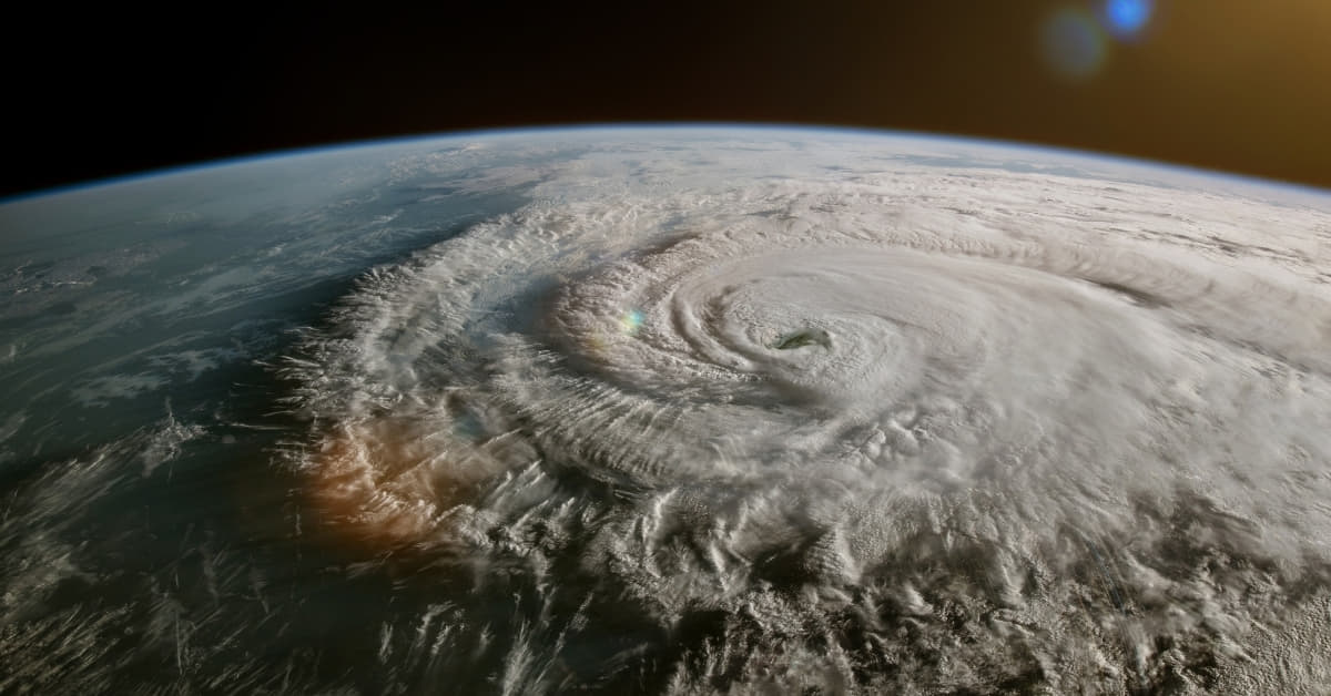
In agriculture, satellite photography helps monitor crop health, assess soil conditions, and optimize farming practices, contributing to increased productivity and sustainability. - Meteorology:
Satellites play a crucial role in weather forecasting by capturing real-time images of cloud patterns, atmospheric conditions, and other meteorological phenomena. - Mapping and Navigation:
Satellite imagery forms the basis for accurate maps and navigation systems, facilitating transportation and exploration.
Advancements in Satellite Photography
- High-Resolution Imaging:
Modern satellites are equipped with advanced sensors that capture images with unprecedented clarity and detail, enabling more accurate analysis and interpretation. - Constellations of Satellites:
Constellations of small satellites are being deployed to provide continuous coverage and faster revisit times, improving the frequency of data acquisition. - Artificial Intelligence Integration:
AI algorithms are now integrated into satellite systems to automatically process and analyze vast amounts of imagery, extracting valuable insights more efficiently.
FAQs
How does satellite photography differ from aerial photography?
Satellite photography involves capturing images from satellites orbiting the Earth, providing a global perspective. Aerial photography, on the other hand, is taken from aircraft flying at lower altitudes and offers higher resolution but is limited to specific regions.
Can satellite photography capture images at night?
Yes, some satellites are equipped with sensors that can capture images in low-light conditions, allowing for nighttime observations. However, the quality may vary compared to daytime images.
Are there privacy concerns associated with satellite photography?
Privacy concerns do exist, and regulations vary globally. Governments and organizations are working to establish guidelines to address privacy issues related to satellite imagery.
How often are satellite images updated?
The frequency of updates depends on the satellite and its mission. Some satellites provide daily updates, while others may revisit specific areas every few weeks.
Can individuals access satellite imagery?
Yes, several online platforms provide access to satellite imagery for free or through subscription services. Google Earth and NASA’s Worldview are popular examples.
Conclusion
Satellite photography stands at the forefront of technological innovation, offering a unique perspective that continues to reshape our understanding of the world. As advancements in this field persist, the applications and benefits of satellite imagery are likely to expand, contributing to a more sustainable and informed global society.
This page was last edited on 27 February 2024, at 12:26 pm