Aerial photography offers a breathtaking perspective of the world from above, capturing landscapes, cityscapes, and natural wonders in stunning detail. From majestic mountains and sprawling cities to serene coastlines and intricate patterns, aerial photographers have the unique ability to showcase the beauty and diversity of our planet from a bird’s-eye view. In this guide, we’ll explore the fascinating world of aerial photography, its history, techniques, equipment, and tips for capturing breathtaking aerial images.
Understanding Aerial Photography
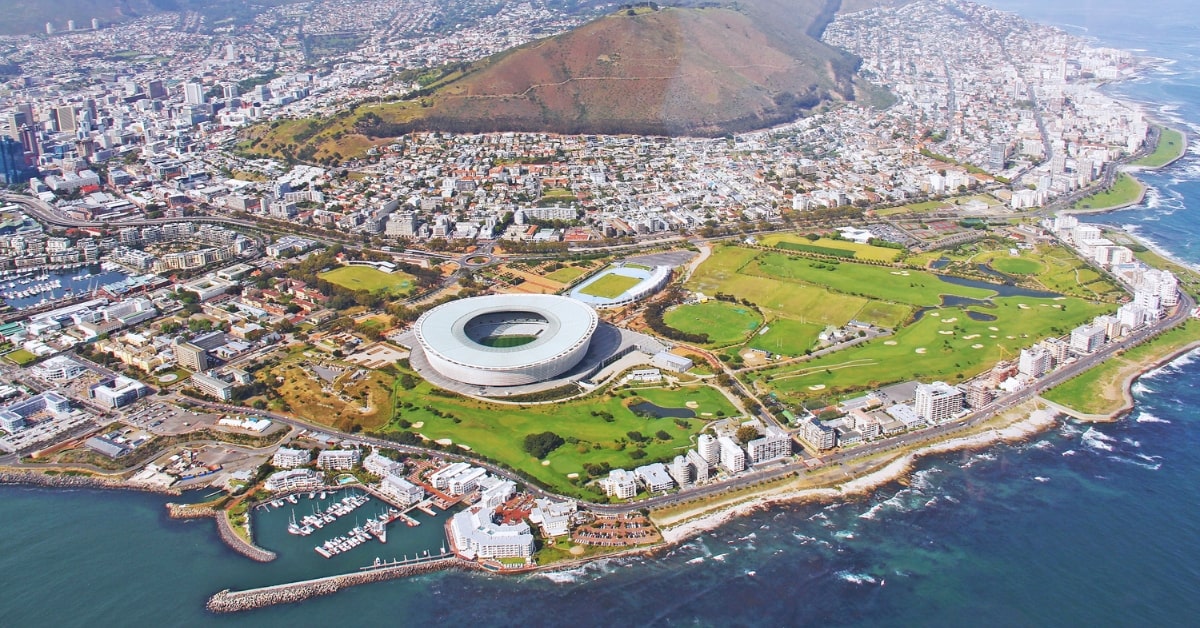
Aerial photography involves capturing images of the Earth’s surface from an elevated vantage point, typically from aircraft, drones, or other airborne platforms. It provides a unique perspective that reveals patterns, shapes, and features not visible from the ground, offering a fresh and captivating view of familiar landscapes and landmarks. Aerial photography is used in various fields, including cartography, urban planning, environmental monitoring, and artistic expression.
Why Aerial Photography Matters?
Aerial photography serves as a powerful tool for documenting, analyzing, and interpreting the Earth’s surface from above. It provides valuable insights into land use, environmental changes, and geographic features, aiding in urban planning, disaster response, and scientific research. Aerial photographs also serve as visual records of our changing world, capturing moments in time and preserving them for future generations.
Key Techniques in Aerial Photography
- Composition: Composition is key to creating compelling aerial photographs. Aerial photographers must consider elements such as perspective, framing, and scale to capture dynamic and visually engaging images.
- Lighting: Lighting plays a crucial role in aerial photography, influencing the mood, atmosphere, and visual impact of the image. Golden hour, the period shortly after sunrise or before sunset, is often preferred for its soft, warm light that enhances colors and textures. However, aerial photographers must also be mindful of harsh shadows and glare, especially when shooting during midday.
- Camera Settings: Aerial photographers must adjust camera settings to optimize image quality and sharpness. Use a fast shutter speed to freeze motion and minimize blur caused by aircraft vibrations or wind. Select a moderate aperture (f/8 to f/11) for optimal sharpness and depth of field, and adjust ISO settings to maintain a balance between exposure and noise levels.
- Stabilization: Achieving sharp and clear aerial images requires stabilizing the camera to minimize motion blur and camera shake. Use gyro-stabilized mounts, vibration-dampening systems, or electronic stabilization features to ensure steady shots, especially when shooting from helicopters or small aircraft.
Aerial Photography Process: Step by Step
- Planning: Before the flight, research the area you’ll be photographing and identify key points of interest or landmarks. Plan your flight path, taking into account airspace regulations, weather conditions, and safety considerations. Communicate with pilots or drone operators to coordinate the flight plan and ensure a smooth shooting experience.
- Preparation: Prepare your camera equipment, ensuring batteries are fully charged, memory cards are formatted, and lenses are clean and free of debris. Pack essential accessories such as lens filters, lens hoods, and lens cloths to optimize image quality and protect your gear during the flight.
- Execution: During the flight, remain alert and attentive to changes in lighting, weather, and landscape. Communicate with the pilot or drone operator to adjust altitude, speed, and direction as needed to capture the desired shots. Take a variety of images from different angles and perspectives to maximize creative opportunities.
- Post-Processing: After the flight, review and select the best images for post-processing. Use editing software to enhance colors, contrast, and sharpness, and to remove any distractions or imperfections.
Benefits of Aerial Photography
- Perspective: Aerial photography offers a unique perspective that reveals patterns, shapes, and features not visible from the ground, providing valuable insights and perspectives on the Earth’s surface.
- Documentation: Aerial photography serves as a valuable tool for documenting environmental changes, land use patterns, and geographic features, aiding in scientific research, environmental monitoring, and urban planning.
- Artistic Expression: Aerial photography allows photographers to express their creativity and artistic vision, capturing breathtaking landscapes, cityscapes, and natural wonders from a fresh and captivating perspective.
FAQs
Do I need special permission to fly drones for aerial photography?
Yes, in most countries, drone operators are required to obtain permission from aviation authorities and adhere to regulations governing drone flight, including airspace restrictions, altitude limits, and safety guidelines.
What type of aircraft is best for aerial photography?
The choice of aircraft depends on factors such as budget, location, and shooting requirements.
How can I ensure sharp and clear aerial images?
To achieve sharp and clear aerial images, use fast shutter speeds to freeze motion, stabilize the camera to minimize vibration and camera shake, and maintain optimal focus and aperture settings.
This page was last edited on 28 February 2024, at 4:13 pm